Blog |
Discussing current issues in engineering
|
 Photo credit: Unknown, CC BY-ND 2.0 The Navajo Nation retains the largest land area of any indigenous tribe in the United States. Navajo land spans 27,000 square miles—an area larger than West Virginia—and occupies territory in three states: Arizona, Utah, and New Mexico. More than 173,000 of the 298,000 enrolled Navajo members live on Navajo Nation soil.
According to the Indian Health Service (IHS) and the Navajo Tribal Utility Authority, an estimated twenty to thirty percent of the Nation’s residents do not have access to piped water in their homes. Most occupants of homes without piped water rely on hauled water. In some cases, occupants may rely on bottled water for drinking, cooking, cleaning, and bathing. The COVID-19 pandemic, which has rocked the Navajo Nation with 30,350 cases to date, exacerbated preexisting strains placed on Navajo communities through insufficient and unreliable water access. To combat these deficits, advocates from a variety of sectors—Navajo Nation and federal officials, nonprofits, universities, utility providers—united to form the Navajo Nation COVID-19 Water Access Coordination Group (WACG) which aims to increase tribal homes’ access to safe, quality drinking water. Last year, in an effort to further WACG's mission, the Indian Health Service and Navajo Engineering & Construction Authority (with the help of Federal CARES Act funds) installed small hydrants connected to piped water throughout the Navajo Nation, creating 58 new transitional water points available to tribal households. This more than doubled the 48 existing water access points in the Navajo Nation. Furthermore, for the duration of the Navajo Nation COVID-19 Public Health Emergency, CARES Act funds enable the WACG to waive water fees and provide water storage containers and disinfection tablets free of charge. Funding has equipped the WACG to expand water access in the Navajo Nation during the COVID-19 pandemic, but health, human services, and Native justice advocates continue to search for economically feasible infrastructure expansion solutions that will last beyond the current health crisis. As facilities on tribal lands near the end of their life expectancy, more systems need maintenance and replacement, resulting in high estimated construction costs passed on to consumers who may not be able to afford higher utility costs. Rex Kontz, deputy general manager of the Navajo Tribal Utility, says that when it comes to raising utility rates, “all you’ll get is a bunch of people disconnected for nonpayment.” While there is still an effort to supply homes with piped water, long term solutions to Navajo water inaccessibility may look different from solutions found in many parts of the United States. Navajo officials and utility providers are considering large water loading stations with high flow rates that could serve more residents than the new water access points. WACG members, including the IHS and Johns Hopkins University, are also assessing tech-based solutions like hydropanels and solar powered filters at wellheads. For more on the Navajo Nation Water Access Coordination Group, click here. To read more about water access points installed in the Navajo Nation, click here. 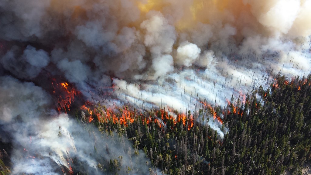 Photo credit: Mike Lewelling, Public Domain Mark 1.0 President Biden’s recent unveiling of the $2 trillion American Jobs Plan renews emphasis on improvements to underperforming infrastructure. As the U.S. enters warmer months, wildfires and wildfire prevention will resume a chief position among infrastructure concerns.
2020 was the worst wildfire season experienced by America’s western states in 70 years. Thousands of Americans evacuated their homes throughout the season, and residents in and around wildfire-stricken areas endured air quality that ranked among the worst in the world. Last week, the American Society of Civil Engineers (ASCE) hosted an ASCE Interchange interview with Geoff Coleman, a wildfire resilience expert and the vice president of California-based engineering firm BKF Engineers. Coleman spoke with Interchange’s Casey Dinges on key considerations for the future of wildfire-resilient infrastructure in America. Coleman stressed the importance of public education on wildfire risks and mitigation strategies in fire-prone areas. He recommended that individuals consider evacuation routes and defensible space—the area around a structure designed to reduce fire danger—in home planning and maintenance, and suggested alternatives to traditional grass yards like rock gardens and drought-resistant, high moisture succulents. More significantly, Coleman stressed the role that civil engineers and appointed officials must play in limiting community fire risks. When fires take hold of a wildland area, entire communication systems, water supplies, electric grids, and transportation networks are threatened. Coordination among emergency responders can be interrupted through the destruction of remotely located communication towers. Burning plastics and industrial materials may contaminate water that is then drawn back into municipal water supplies. An inability to isolate electric services can lead to mass shutdowns. In order to diminish these possibilities, engineers and community leaders can focus on increasing defensible space around essential structures like water towers, cell towers, and power stations. Better yet, these essential structures can be located outside of fire-prone areas. Roads should be designed with evacuation, response, and reconstruction in mind: paved with compliant turnarounds, multiple points of egress, and widths in excess of forty feet to enable transportation of sufficient water supplies during a fire event and construction equipment in the aftermath. Lastly, Coleman stressed the importance of introducing fire safety and prevention early into the design process through the involvement of fire code officials. The combined vigilance of engineers and their communities is required to create infrastructure that prioritizes public safety in wildfire-prone areas. To view ASCE Interchange’s interview with Geoff Coleman, click here. 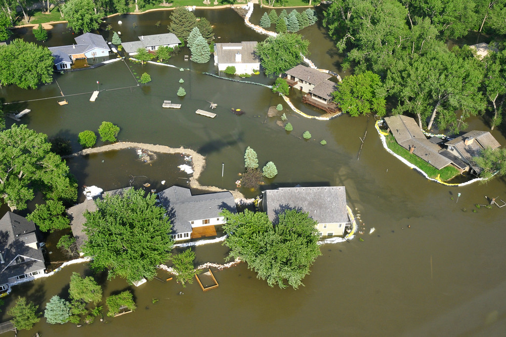 Photo credit: TSGT Oscar M. Sanchez, CC BY-ND 2.0 Homeowners and renters alike may be familiar with the Federal Emergency Management Administration (FEMA)’s Flood Maps, which provide a visual representation of a community’s flood risk. The National Flood Insurance Program (NFIP), which is managed by FEMA, uses community flood risks gathered from FEMA maps to calculate insurance rates for its more than 5.1 million policyholders—policyholders who, by many accounts, used FEMA flood maps to calculate their potential risk and therefore inform policy-buying decisions in the first place.
Unfortunately, FEMA maps were created to represent risks at a community level, and consequently do not serve as an accurate measure of risk for individual properties. The flood risk research nonprofit First Street Foundation uses modeling techniques to fill in these informational gaps, thereby establishing the first public collection of property-level flood risk data in the United States. In a 2020 report, First Street Foundation’s team of researchers found that 14.6 million properties across America were characterized by substantial flood risk (a one-percent chance of annual flooding). Millions of these property owners may have been previously unaware of their risk because their properties were located outside of FEMA’s Special Flood Hazard Areas and were therefore excluded from FEMA Flood Maps. In a study published last month, First Street Foundation noted that some property owners took steps to mitigate potential flood damage in 2020, thereby decreasing the number of residential properties at risk of unmitigated flood-related financial loss to 4.3 million. This decrease shows marked improvement for many properties once at unabated risk. Nonetheless, the February report makes it clear that underestimated flood risk remains a significant financial threat to millions of American households. The discrepancy between supposed flood risk and actual flood risk is evidenced by substantial difference between premium flood insurance rates and estimated financial costs to properties as a result of flooding events. The average NFIP premium for the 5.7 million American properties with any flood risk is $902, while the average estimated loss for these same properties is $3,343 per year. This means that the current economic risk to 5.7 million properties is 3.7 times higher than the NFIP’s insurance pricing. The disparity continues to grow as sampled data is limited to the 4.3 million properties with substantial flood risk, where the average estimated annual loss of $4,419 is 4.5 times greater than the NFIP’s premium of $981. The First Street Foundation’s February report highlights the need for increased flood risk awareness among American property owners and increased flood insurance coverage among insurers. As flood events become more widespread and intense due to climate change, America’s number of at-risk properties will continue to rise. Visit FloodFactor.com to access current flood risk data for 142 million public and private properties. Click here to read the First Street Foundation’s February 2021 report. Every four years, the American Society of Civil Engineers (ASCE) releases its assessment of the current condition and needs of United States infrastructure. The Report Card for America’s Infrastructure takes the form of a school report card, with grades designated from A to F, as an easily identifiable (and modestly tongue-in-cheek) depiction of where our nation’s infrastructure stands in relation to our public safety, health, economic, and security goals.
This year, America ranked just below average at a C- overall. This is up from a D+ in 2017 and marks the first time that American infrastructure has ranked above the D range in two decades, indicating incremental progress in infrastructure restoration. According to Ruwanka Purasinghe, EIT, A.M.ASCE, a member of the committee that determines the quadrennial grade, “the overall grade of a C- shows that we’re on the right track but have a ways to go.” The Infrastructure Report Card overall grade is derived from the assessment of seventeen individual categories—aviation, drinking water, energy, public parks, schools, stormwater, and transit, to name a few. Like nearly every other aspect of American societal life, all seventeen categories have faced heightened strain throughout the pandemic as COVID-19 continues to impact revenue streams intended for infrastructure. At the same time, climate change tests the limits of our existing structures and related severe weather events impede potential restoration efforts. Now more than ever, infrastructure networks require attention and investment in order to overcome the obstacles before them. The ASCE cites three significant trends that contribute to report results for all assessed sectors. Firstly, the society highlights maintenance backlogs, a persistent issue also featured in the 2017 Report Card, as a cause of poor system performance. Nonetheless, the ASCE notes that new technology and appropriate asset management are helping to bridge the gap between limited funds and necessary maintenance. Secondly, in the last four years, federal, state, and local governments have made positive impacts on sectors through financial and human investment. For example, more than 25 major cities and states have now appointed chief resilience officers in order to promote resilience building at the state and local level. Lastly, the ASCE notes that some infrastructure sectors suffer from a scarcity of condition information and reliable data. When it comes to stormwater, for example, a dearth of updated asset records prevents accurate estimations for the lifespans of stormwater conveyance systems across the country. When the ASCE unveiled the 2021 report at a virtual news conference last week, representatives from all corners of industry and politics voiced the need for bipartisan support on infrastructure investment. With a mounting annual investment gap of nearly $260 billion, America’s infrastructure can wait no longer. Infrastructure shortcomings demand resolutions—our collective economic foundation and quality of life depend on it. To read the ASCE’s 2021 Report Card for America’s Infrastructure, click here.  Photo credit: John Christian Fjellestad, CC BY 2.0 As the pandemic continues to draw attention to infrastructure shortcomings all over the globe, engineers and city planners must ask themselves how they can contribute equitable and accessible industry decisions to a post-pandemic world. In an effort to confront this question, California’s Los Angeles County hosted a series of five webinars last year at the Los Angeles Headquarters Association, an organization designed to advance economic growth in the county.
The series ran from July to November and featured a long list of influential panelists including an L.A. City planning commissioner, regional non-profit executive, chief design officer at the L.A. mayor’s office, Lyft senior public policy manager, architects, and designers. Panelists addressed pervasive issues made plainer by the pandemic and our country’s present grappling with institutionalized racism and racial inequality. Because engineering and design professionals have traditionally held a significant role in land use decision-making, panelists placed a focus on the professional’s duty to address the needs of a community. In the past, engineers have been key players in an approach that tells communities what they will receive without addressing (or even seeking out) the concerns of community residents. Take, for example, the fact that women, specifically women of color and mothers with children, are more likely to ride the bus than men. Yet bus stops all around the country are essentially designed for the use of 30-year-old white men—individuals who may not be threatened by standing in the dark at night, or in the summer sun for twenty minutes. Furthermore, as discussion moderator Katherine Perez points out, community land-use decisions have often unevenly damaged diverse and low-income neighborhoods. Consider decisions regarding landfill or freeway locations—or any other variety of less-desirable infrastructure for that matter. Webinar discussions highlighted the power that engineers have to address issues of equity through their creativity and influence on project budgets. As panelist Paul Moore, P.E., of the Arup professional services firm states, “[W]hile policymakers and planners can have fantastic ideas and intentions about how to reshape cities, it’s engineers who are often empowered to implement the ideas.” The Los Angeles Headquarters Association webinars publicized the role of engineers in inclusive infrastructure. Moving forward, engineers around the world are responsible for the creation of equitable and sustainable value accrual practices through their infrastructure and design projects. To learn more about the L.A. Headquarters Association webinars and panelists, click here. 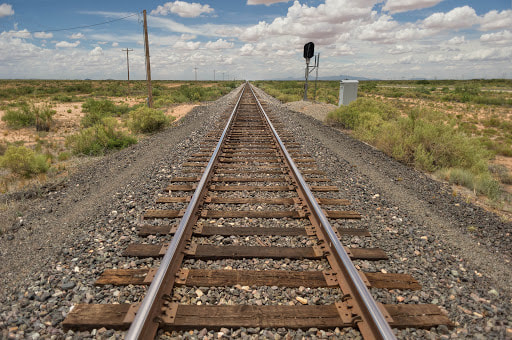 Photo credit: Bo Nielsen, CC BY-NC-SA 3.0 The Nebraska-based railroad service contractor EnviroRail recently licensed Mechanical Concrete, an industrial strength aggregate confinement technology, marking a first for the future of sustainable railroad construction and maintenance.
All roads require regular maintenance throughout their lifespans. This is due in part to the fact that most road foundations, including railroad foundations, are comprised of compacted stone aggregate which weakens when wet. As pressure is applied to the wet aggregate particles spread out laterally resulting in a loss of road structure. This process yields features like ruts, potholes, and collapsed road edges. Railroads are particularly susceptible to this form of deterioration because of the high pressure loads typically transported by rail. Samuel G. Bonasso, P.E., the creator of Mechanical Concrete, realized that in order to slow down this cycle of road deterioration and maintenance he needed to address the structural issue associated with loss of road base structure. His solution was simple: to prevent the loss of road structure, prevent aggregate lateral spread. What’s more, Bonasso incorporated a readily-available, oft-discarded industrial waste product into his process, creating a reliable and sustainable materials sourcing practice. Each year, more than three hundred million waste auto tires are generated in the United States. And while tire recyclers make use of some eighty percent of waste tires through the recycling process, roughly half of those recycled tires are then burned for tire-derived-fuel. Mechanical Concrete is the first large-scale reuse alternative for discarded tires. Mechanical Concrete uses waste auto tires to contain stone aggregate, thereby preventing the majority of aggregate lateral spread. Waste tires are stripped of their side walls to create a durable rubber cylinder and then filled with a granular aggregate. The resultant product creates a foundation that is stronger and more dependable than aggregate used in isolation. In demonstrations hosted by West Virginia University’s School of Engineering, Mechanical Concrete proved three times stronger than traditional road foundations, and ultimately required seventy-five percent less maintenance. The recent contract between EnviroRail, as a nationwide railroad services contractor, and Mechanical Concrete provides encouraging evidence for a new era of railroad maintenance and sustainability. Click here to learn more about EnviroRail’s contract with Mechanical Concrete. For more information on Mechanical Concrete, visit the company site. Hospitals have struggled to make space for influxes of COVID-19 patients since early in the pandemic. In counties around the country, continued surges of the virus now affect medical services for any individual who may need care, regardless of whether the individual suffers from COVID-19. Health districts have been forced to respond to diminished ICU bed capacities with creative measures. For New York State’s Long Island region, as for many other areas around the country, these measures have taken the form of temporary field hospitals.
The placid, wooded campuses of Long Island’s Stony Brook University (SBU) and SUNY College at Westbury host two of these temporary hospitals. The structures are hulking, frame-supported tents that add a combined 2,060 beds to the area’s medical network. Each tent is comprised of heavy-gauge vinyl panels that are individually tensioned and bolted to a metal framework. Prior to construction, engineers faced the difficult task of securing a stormwater control system for projects with two major flooding factors stacked against them. Firstly, the tents would be constructed on poorly drained turf fields and thereby posed a flood risk in the presence of a medium rainfall event. Secondly, the heavy-gauge vinyl material that would ensure a leak-proof final product also made rain cascade faster down the roofs of the tents—in this case, engineers anticipated a maximum rate of 1,230 gallons a minute. If left unchecked, this could accelerate damage to foundations or result in seeping from a structure’s base. A conventional frame-supported tent utilizes gutters and downspouts to catch and route stormwater. Project engineers needed to take this approach one step further by redirecting stormwater far away from the vulnerable turf. They selected 12-inch double-walled corrugated pipe for its flexibility and local availability. The pipe’s light weight allowed single workers to manipulate and secure large sections at a time, while its flexibility enabled ninety-degree connections aboveground. Beginning at the field hospital gutter systems, the corrugated pipe bends down and around the tent structures, passing underneath ambulance roadways and eventually into underground swales designed to contain large quantities of runoff and facilitate its percolation. The use of corrugated pipe enabled SBU and SUNY field hospital project engineers to confront flooding factors without sacrificing construction speed or versatility. In both cases, the whole construction process took about three weeks. The hospitals were ready to accept patients in April 2020. To learn more about stormwater drainage for SBU and SUNY field hospitals, click here. To learn more about the temporary fabric structures frequently used in field hospital designs, click here. 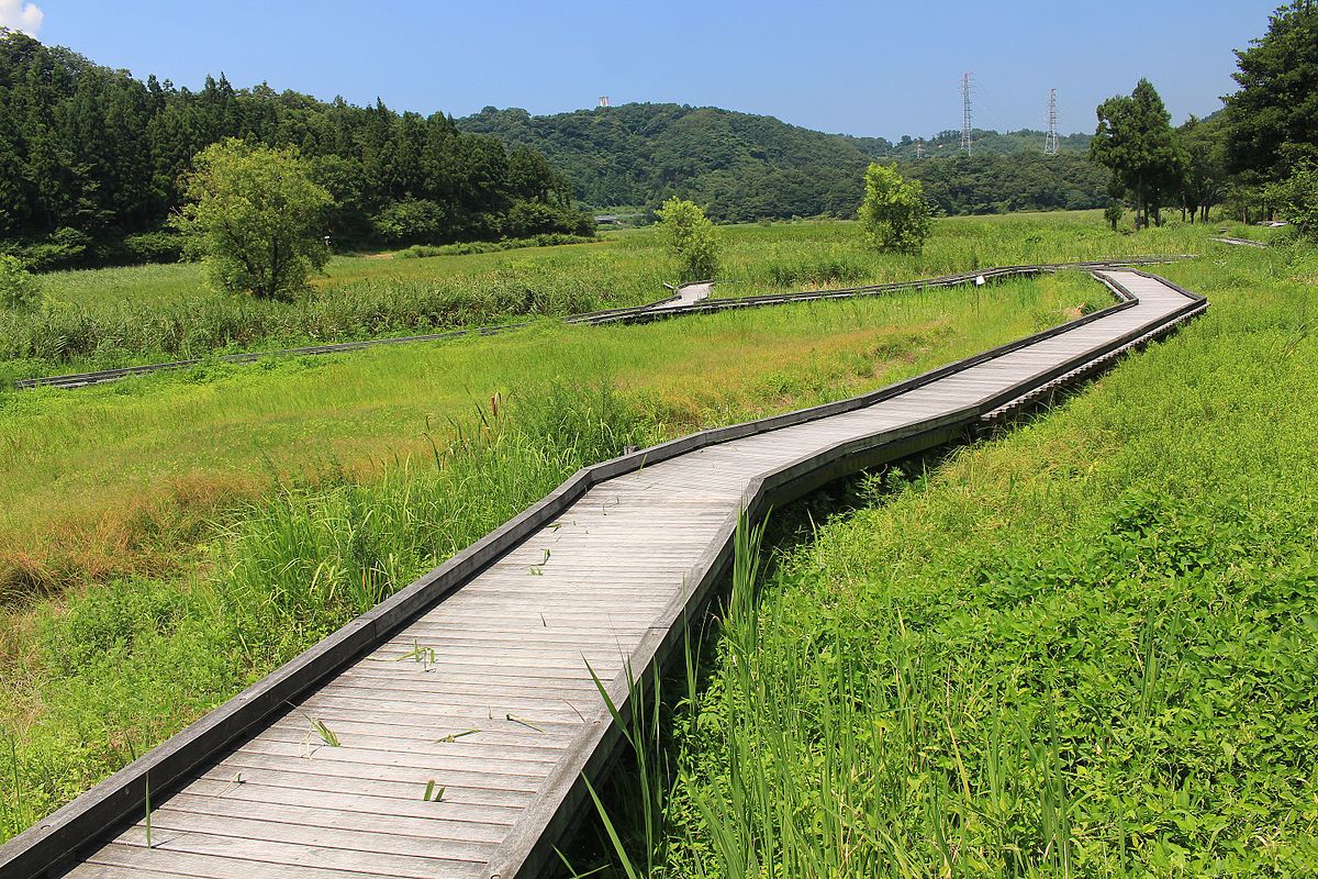 Photo Credit: Alpsdake, CC BY-SA 4.0 The City of Hampton, Virginia, recently joined a short list of U.S. communities spearheading green infrastructure investment through the use of Environmental Impact Bonds (EIBs).
First developed by D.C.-based social investment firm Quantified Ventures, EIBs are a financing tool that encourages investment in green infrastructure by linking financial returns to measurable performance outcomes. Public utilities issue the bonds alongside performance targets and timeframes, and independent parties assess project success through the achievement of said targets. EIBs can be used to fund pilot approaches to sustainable infrastructure or to scale up lab-tested environmental projects. The EIB’s outcomes-based financing approach helps to stabilize green infrastructure investments, which can be risky due to the varying efficacies of individual green projects, and thereby increases venture capital opportunities for communities interested in going green. For the City of Hampton, this EIB will equate to approximately $12 million in stormwater-related infrastructure projects with the end goals of reducing pollution and enhancing the city’s resilience to flooding events. Hampton is bisected by Newmarket Creek, a tributary of the two-mile-long Back River that eventually feeds into the Chesapeake Bay. In recent years, severe weather events and sea level rise have led to the increased flooding of Newmarket Creek. Hampton’s planned green infrastructure projects would combine to expand the stormwater storage capacity of the Newmarket Creek watershed by an excess of 8.6 million gallons. With sea levels and the occurrence of severe weather predicted to continue rising, these projects will provide valuable security against future flooding events while also creating neighborhood assets for Hampton residents. Project designs include a series of manmade wetlands and detention ponds that combine to form a “stormwater park,” extensive vegetation installations, and an increase in elevation for a major city road. You can learn more about the City of Hampton’s Environmental Impact Bond and green infrastructure projects here.  Photo credit: Steven Pavlov, CC BY-SA 4.0 Research into a new bridge design offers potential relief for the expensive and dangerous threats posed to bridges by seismic events.
Contemporary bridge designs follow a monolithic model: forms are constructed then concrete is poured over the forms, yielding a final structure. These traditional monolithic bridges are strong enough to support their own weight plus additional loads such as traffic but are often damaged by unexpected seismic events like earthquakes. Restoration to a bridge damaged by seismic activity is a lengthy and expensive process, and the damage itself can result in injuries and loss of life. In recent months, researchers at the University of Colorado Boulder and Texas A&M University set out to evaluate a theoretical bridge design, called the hybrid sliding-rocking (HSR) bridge, that aims to mitigate the issues plaguing traditional bridges as a result of seismic events. Where a monolithic bridge emphasizes unyielding concrete, an HSR bridge offers columns containing limb-inspired joints that slide and rock to diffuse seismic energy as it travels through the ground. Not only is an HSR bridge more capable of energy dispersal—the uniquely complex sliding-rocking interaction also allows HSR bridges to self-center amidst seismic activity, almost like the adjustments to joint movement made by a person who has achieved “sea legs.” Researchers at CU Boulder and Texas A&M conducted earthquake simulations on experimental HSR columns and found that the HSR columns sustained less damage when compared to practical evaluations of conventionally designed columns. Damages sustained by the HSR columns also proved relatively quick to fix with common restoration materials. Although HSR bridge design remains theoretical, with no practical implementation into real world bridges at this time, findings from this latest research study generate optimism for the future of bridge safety and durability amidst seismic activity. You can learn more about the research study conducted by CU Boulder and Texas A&M here.  Photo credit: Shawn Ullerup, CC BY 4.0 The American Society of Civil Engineers (ASCE) just released their first-ever Report Card for West Virginia’s infrastructure, giving the state an overall grade of “D”. This grade indicates the state’s infrastructure is in poor condition with new construction and repair efforts unable to keep up with the state’s needs. The report card was also broken down into infrastructure categories giving grades for bridges (D+), dams (D), drinking water (D), roads (D+), and wastewater (D).
The report found that of West Virginia’s 7,291 bridges, 21% are structurally deficient, which is significantly greater than the national average of 7%. Of the 38,854 miles of public roads in West Virginia, 31% are in poor condition compared to 21% nationally. As a result, the ASCE report estimates that it costs $723 per motorist per year from driving on roads in need of repair in West Virginia. Dams in West Virginia were also rated as poor with 75% of the state’s dams classified as high-hazard potential, indicating failure would result in significant economic loss and loss of life. The state would reportedly need more than $900 million in funding to continue operation, maintenance, and repair of high hazard dams. Lastly, an estimated $1.39 billion is needed in drinking water infrastructure over the next 20 years with West Virginia currently losing more than 50% of their treated water due to leaks in infrastructure. Significant portions of West Virginia’s wastewater systems have also deteriorated with 59 combined sewer systems needing $1.2 billion in funds to address state and federal requirements. Some encouraging prospects, however, include the establishment of the West Virginia Roads to Prosperity Program in 2017 that will ultimately invest $2.8 billion in more than 700 road and bridge projects and create over 48,000 jobs. In addition, inter-agency collaborations are expanding access to resources to upgrade drinking water and wastewater infrastructure to meet new quality standards. And overall, it’s important to note that West Virginia’s “D” infrastructure grade is on par with the nation’s overall D+ grade from the most recent 2017 infrastructure report card for the United States. You can read West Virginia’s full ASCE infrastructure report card here. |
Colman Engineering, PLCA professional engineering firm located in Harrisonburg, VA Archives
January 2022
|


 RSS Feed
